Nauru
©
Nauru

Nauru

Tiny Central Pacific island country shaped by a narrow coast and a phosphate-mined limestone interior.

Nauru is one of the strangest places on Earth. The world's third-smallest country — only Monaco and the Vatican are smaller — sits just south of the Equator in the Central Pacific, a raised coral island barely 21 square kilometres in area. Its 11,000 or so residents live almost entirely on a narrow coastal strip, because the interior is largely uninhabitable: stripped bare by a century of phosphate mining, it looks like a moonscape of jagged limestone pinnacles and abandoned machinery.

For much of the 20th century, Nauru was extraordinarily wealthy. The phosphate deposits underlying the island — ancient seabird guano compacted over millennia — made it briefly one of the highest per-capita-income countries in the world. The money was spent rather than invested, the reserves were exhausted, and Nauru spent the early 2000s on the verge of bankruptcy. The economy has never fully recovered.

Since 2001, Nauru has hosted Australia's offshore asylum seeker processing centre — the so-called "Pacific Solution." The arrangement was suspended, then revived, and as of 2025 remains operational, with over 100 people detained while their claims are processed. It is controversial and impossible to ignore when visiting.

Nauru is not a conventional tourist destination. Fewer than a few hundred visitors arrive each year. There are no resorts, no tourist infrastructure to speak of, and most food is imported. But for travellers who want somewhere genuinely off the map — WWII relics, a freshwater lagoon surrounded by jungle, a reef you can snorkel without another soul nearby, and a story that encompasses colonialism, resource extraction, and one of the world's most acute public health crises — Nauru is unforgettable.

Guide

Books

There is not a large body of travel writing about Nauru, which is part of what makes it interesting.

The Nauru File — various journalists and researchers have written about Australia's offshore processing arrangement from an investigative angle. The Refugee Council of Australia and the Australian Broadcasting Corporation have extensive archives if you want to understand the detention centre before arriving.

Nauru: Environmental Devastation under International Trusteeship by Christopher G. Weeramantry (ISBN 0195532899) is the most serious academic treatment of what phosphate mining did to the island and to international law. Weeramantry later became a judge on the International Court of Justice and Nauru's legal battles against Australia over environmental damage were partly his work.

Pacific Ruin: The Phosphate History — the broader story of phosphate island mining across the Pacific is told in various environmental history books. Banaba (Ocean Island) and Christmas Island share aspects of Nauru's story and reading about the region gives context for what you will see.

For general Pacific context, try Paul Theroux's The Happy Isles of Oceania, which captures the strangeness of travelling in Micronesia and Polynesia without visiting Nauru specifically.

Guide

Food

Eating in Nauru requires low expectations and flexibility. Almost all food is imported from Australia, arriving by ship or air at irregular intervals — sometimes as infrequently as every six to eight weeks. Between deliveries, fresh produce is scarce or unavailable, and shop shelves can look bare.

The main hotels — primarily the Menen Hotel — have restaurants that offer the most reliable meals. Expect Western food alongside Chinese dishes; Chinese-run restaurants are common on the island. Seafood appears on menus and is worth ordering when available.

Traditional Nauruan diet centred on fish, coconut, and pandanus fruit. That diet has largely been displaced by imported processed food, a shift directly linked to the island's severe public health crisis. Fresh fruit and vegetables are hard to find and expensive.

There are a handful of small shops and takeaway places around the island, but don't rely on them for every meal. Stock up on snacks and long-life supplies when you see them, in case the next delivery hasn't come in.

Guide

Getting Around

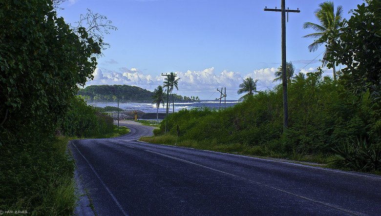
Getting around Nauru is simple. A single sealed road runs 19 kilometres around the entire perimeter of the island — you can circuit it in under an hour. A few kilometres of inland road connect the coast to the Buada District, the lagoon, and the phosphate mining areas.

Taxis are available and inexpensive by Western standards. Car hire is possible through a small number of local operators — ask at your hotel or guesthouse. A local bus service runs along the ring road, though it does not run to a fixed published timetable.

Cycling around the island is a realistic option for the reasonably fit. The road is flat near the coast. A bicycle hired for a day will cover everything there is to see on land. Bring water — it gets hot.

The phosphate mining areas in the interior are accessible by road or on foot. Some areas remain active mining sites; others are abandoned. A short railway once ran phosphate to the coast, though it is no longer in regular use.

Guide

Getting There

By Air

The only practical way to reach Nauru is by air. Nauru Airlines (formerly Air Nauru, IATA code ON) operates the island's sole air links. As of 2025, the airline flies from Brisbane (Australia), Nadi (Fiji), and Tarawa (Kiribati), with connections onward to Micronesian islands including Pohnpei, Majuro, and Palau. Brisbane and Nadi are the main entry points for international travellers, both offering worldwide connections.

Flights are infrequent — typically a few times a week per route — and schedules change regularly. Runway works at Nauru International Airport (INU) are periodically scheduled, which can disrupt services. Check the Nauru Airlines website (nauruair.com) for current schedules before booking anything else.

The airport is a short drive from the main settlement of Yaren. Taxis and informal lifts are available on arrival.

Visas

Nearly all visitors require a visa in advance. A handful of Pacific island nationalities receive visa-on-arrival, but most travellers — including those from Australia, the United States, and Europe — need to apply beforehand. The fee is around A$100 and processing can take several weeks, so apply at least a month before travel. Contact the Nauru consulate or embassy in your country, or the Department of Foreign Affairs in Nauru.

By Sea

There is no regular passenger shipping service to Nauru. Cargo vessels call periodically, but arranging passage is difficult and unreliable. The open ocean approach is complicated by deep-water anchorages — the reef prevents vessels from docking close to shore — so freight and fuel are offloaded by barge. Unless you are arriving on a yacht, fly.

Guide

Highlights

Anibare Bay is Nauru's finest beach — a long arc of white sand on the eastern coast with clear water and good snorkelling on the reef. It is calm and largely deserted. The underwater visibility is excellent.

Buada Lagoon sits in the interior of the island, surrounded by tropical vegetation. It is the only freshwater body on Nauru and feels remarkably lush given the devastated landscape around it. Local children swim here. Walking paths connect it to the coast.

Command Ridge is the island's highest point — around 71 metres above sea level, which passes for dramatic on a flat coral island. During the Japanese occupation in World War II it served as an observation post. Bunkers and gun emplacements are still visible. The views across the island are striking, particularly of the phosphate wasteland and the coast beyond.

The Phosphate Moonscape is not pretty, but it is one of the most honest landscapes on Earth. The interior of Nauru — roughly 80 percent of the island's land area — was strip-mined over the course of a century. What remains is a field of jagged limestone pinnacles called pinnacles or "topside," with abandoned mining equipment rusting among them. The Nauru Phosphate Corporation offers tours. It is sobering and worth seeing.

WWII Relics are scattered around the island. Nauru was occupied by Japan from 1942 to 1945. Coastal gun placements, concrete bunkers, and the rusted hulks of Japanese equipment remain at several sites, particularly near Anibare Bay. The Nauruan wartime experience — including the deportation of hundreds of islanders to Truk — is a significant part of local history.

The Ring Road Circuit takes under an hour by car or a few hours by bicycle. It passes through every district, skirts the reef, and gives a complete picture of the island. There is no better way to orient yourself.

Guide

People

Nauru's population is around 10,000 to 11,000 people. Nauruans are a distinct Micronesian-Polynesian people with their own language, Nauruan, which is unrelated to other Pacific languages and is spoken only here. English is widely understood and used in government and commerce.

Around 58 percent of the population are ethnically Nauruan. The remainder are primarily other Pacific Islanders, Chinese, and Australians, many of them workers connected to the phosphate industry or government services.

Nauruan society has been through extraordinary upheaval in the past half-century. The phosphate boom of the 1960s and 70s made Nauru briefly one of the wealthiest places in the world on a per-capita basis. The government built free housing, free healthcare, and free education. Physical labour was largely outsourced to foreign workers. Then the reserves dwindled, the investments collapsed (a series of ill-fated ventures including a West End musical), and the country entered a prolonged economic crisis.

The health consequences have been severe. Nauru has among the highest rates of obesity and type-2 diabetes in the world. WHO estimates suggest around 94 percent of the adult population is overweight or obese. More than 40 percent have type-2 diabetes. The underlying causes are well understood: the destruction of subsistence agriculture by mining, the shift to imported processed food, and a cultural association between larger body size and prosperity. Life expectancy has fallen sharply as a result, now around 62 years.

Most Nauruans are Christian — roughly two-thirds Protestant and one-third Catholic. Religious practice is central to community life. The pace of life is slow and, outside of the government and the Australian-linked processing operations, largely informal. Visitors are generally treated with warmth and curiosity.

Guide

Practical Information

Money

The Australian Dollar (AUD) is the official currency. Cash is king — credit and debit cards are rarely accepted anywhere on the island. There is one ATM, located at the Capelle & Partner store. Bring enough Australian dollars in cash to cover your entire stay, including unexpected delays. There are no exchange offices on the island.

Getting Connected

Mobile coverage exists on the island. Digicel operates the main network. Wi-fi is available at some hotels and restaurants but is slow and intermittent.

Health

Nauru has a government hospital but medical facilities are limited. For anything serious, medical evacuation to Australia is required. Bring adequate supplies of any prescription medication. Travel insurance with medical evacuation cover is strongly recommended.

Tap water is not reliably safe to drink. Buy bottled water or treat your own.

Food Supply

Most food in Nauru is imported from Australia and arrives by ship or air, sometimes only every six to eight weeks. Stock at shops and restaurants can run low between deliveries. Expect limited choice and occasional shortages. The main hotel restaurants are the most reliable option.

Alcohol

Alcohol is available in hotels and restaurants. There are no significant restrictions on tourists, but be aware that Nauru has a strong Christian culture and modesty is appreciated in public settings.

Departure Tax

A departure tax applies to all passengers leaving by air. As of the most recent information available, this was around A$10–25 per person; confirm the current amount when you book.

Emergency Contacts

Police and emergency services can be reached through the hotel or guesthouse. The island is small enough that help arrives quickly.

Guide

When to Go

Nauru sits almost exactly on the Equator, so temperatures barely vary year-round. Expect highs around 32°C (90°F) and lows around 26°C (79°F) whatever month you arrive. The difference between seasons is mostly about rain.

The dry season runs roughly March to October. This is the better time to visit — more sunshine, less rain, and more manageable humidity. Outdoor activities like snorkelling at Anibare Bay or hiking to Command Ridge are more enjoyable in these conditions.

The wet season runs November to February. Full cyclones are rare this close to the Equator, but expect heavy rain, persistent cloud, and frequent thunderstorms. Travel can be disrupted and the landscape becomes muddier and less inviting.

Given the infrequency of flights, your visit dates will largely be dictated by the airline schedule rather than ideal weather windows. Check Nauru Airlines for current routes and pick the closest dry-season window that works for your connections.