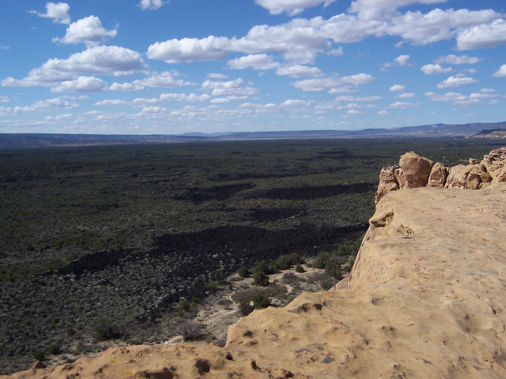
New Mexico national monument near Grants, shaped by lava flows, cinder cones, sandstone bluffs, and lava tubes.
El Malpais means "the badlands," but this national monument near Grants is full of surprises. Lava flows, cinder cones, pressure ridges, and lava tube cave systems up to 17 miles long dominate a landscape that looks genuinely alien — jet-black basalt fields broken only by the occasional ponderosa pine that found a foothold in the rock. Sandstone bluffs and mesas line the eastern edge, giving the whole scene a layered drama that photographs cannot quite capture, and the La Ventana Natural Arch is one of the largest in New Mexico.
For more than 10,000 years people have lived with this landscape. The Puebloan peoples of Acoma, Laguna, and Zuni, along with the Ramah Navajo, maintain spiritual ties to El Malpais and continue ancestral uses of the land. Some of the lava flows are relatively recent — the McCarty's flow to the north is only about 3,000 years old, young enough that Pueblo oral histories may contain accounts of its eruption.
Hiking ranges from easy paved nature trails to serious backcountry routes across the raw lava. The 7.5-mile Zuni-Acoma Trail is an ancient trade route that crosses four distinct lava flows; it is beautiful and strenuous. Bring far more water than you think you need — the dark lava absorbs heat and there is no shade. The national monument visitor center is in Grants. Just outside the monument's western edge, the Ice Cave and Bandera Volcano site pairs a perfect cinder cone with a permanently frozen lava-tube cave.
Guide
Getting There
El Malpais is split by Interstate 40 into eastern and western halves. Most visitors arrive from Grants, the nearest town, just off I-40 about 75 miles west of Albuquerque. The Northwest New Mexico Visitor Center is on the western edge of Grants and is the single best place to start: rangers, free permits for cave hikes, current trail conditions.
Highway 117 runs along the eastern edge of the monument and gives access to Sandstone Bluffs and La Ventana Arch. Highway 53 runs along the western edge and serves El Calderon, the Bandera/Ice Cave site and the western trailhead of the Zuni-Acoma trail. Allow a full day if you want to see both sides; the roads do not loop together and the only crossing is the Zuni-Acoma trail itself, on foot.
There is no public transport. You need a car, ideally one with reasonable ground clearance for the unpaved roads to the more remote sites.
Guide
When to Go
Spring and autumn are ideal. April–May and September–October bring daytime temperatures in the 18–25°C range, cool nights and minimal afternoon thunderstorms. The trails are clear, the cave temperatures are pleasant, and the long lava traverses are realistic.
Summer is unforgiving on the black lava — surface temperatures can exceed 60°C in mid-afternoon — and any hike on the basalt should start at dawn. July and August also bring the New Mexico monsoon, with sudden, violent thunderstorms that can flood arroyos and turn the unpaved roads to mud.
Winter is cold and beautiful. Snow occasionally dusts the lava beds, creating one of the most dramatic landscapes in the Southwest. Daytime temperatures stay above freezing most of the time but nights drop hard. Check road conditions before any winter trip — some side roads close after heavy snow.