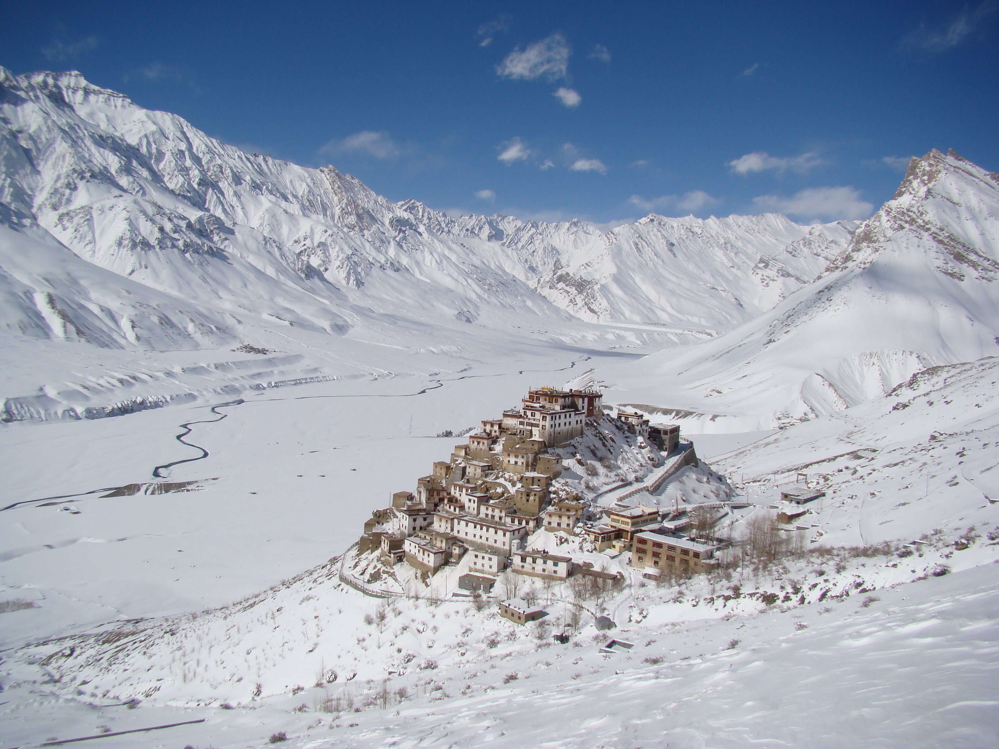
Trans-Himalayan cold-desert valley of Buddhist villages, cliff monasteries, and stark mineral-coloured mountains.
Spiti Valley is one of the most dramatic landscapes in India — a cold desert plateau at 3,800 to 4,500 metres in the Trans-Himalayan zone of Himachal Pradesh, enclosed by stark brown mountains streaked with mineral colours and bisected by the turquoise Spiti River. This is India at its most remote and most spectacular: the landscape looks more like Tibet than anything else in the Subcontinent, which makes sense since it was part of the Tibetan Kingdom until the 16th century. The population is small, Buddhist, and deeply traditional, and the villages cling to cliff faces and river bends in ways that seem almost implausible from a distance.
Getting here is a commitment. The valley is accessible from two directions: via Manali over the Rohtang and Kunzum passes (open roughly June to October), or year-round via the Kinnaur route through Shimla and Reckong Peo, though the roads are narrow, unpaved in stretches, and regularly disrupted by landslides and snow. The effort is precisely the point. Spiti rewards patience with ancient monasteries perched on impossible ridges, fossil beds full of marine creatures laid down when this was all seabed, and skies so clear that the stars feel like they belong to you personally.
The main hub is Kaza, a small market town with guesthouses, ATMs (bring cash anyway), and enough cafes to feel moderately civilised. From Kaza, day trips reach the major monasteries at Key and Tabo, the fossil-rich cliffs at Langza, and the ancient village of Kibber. The short but steep hike to Chandratal Lake, a crescent of impossibly blue glacial water at 4,300 metres, is the single most memorable excursion in the valley.
Permits are required for foreign nationals in some restricted zones — check current requirements in Kaza or Shimla before heading toward the Pin Valley or crossing toward Spiti's northern reaches. The best time to visit is June to September; the valley is effectively snowbound the rest of the year.
Guide
Getting Around
Getting around Spiti requires either your own vehicle (motorcycle or 4WD) or a combination of shared jeeps, local buses, and walking. Kaza is the hub: buses from Kaza serve Tabo and the lower valley, and shared jeeps fill in the gaps. Hiring a vehicle in Kaza for a day costs roughly 2,000-3,500 rupees depending on the route; this is by far the most efficient way to hit multiple destinations.
Motorcycles are popular with experienced riders — the roads are rough, the distances manageable, and the freedom to stop anywhere is significant. Bikes can be rented in Manali. Walking and trekking connects many of the higher villages, including the Hikkim-Langza-Komic circuit, which can be done as a half-day walk from the road.
Altitude is a serious consideration. Kaza is at 3,800 metres, and the villages and passes above it go to 4,500-4,600 metres. Take a day or two to acclimatise in Kaza before heading higher, and watch for symptoms of altitude sickness — headache, nausea, difficulty breathing — which warrant immediate descent. The Spiti Ecosphere office in Kaza is a good resource for logistics and local guide hire.
Guide
Getting There
There are two road routes into Spiti Valley. The northern route from Manali crosses the Rohtang Pass (3,978 metres) and then the Kunzum Pass (4,551 metres) — roughly 200 kilometres to Kaza, taking a full day. The Rohtang Pass requires a permit for non-Himachal Pradesh vehicles (obtainable in Manali the day before); the route is open mid-June to mid-October. Shared jeeps and buses run this route in season, though the road is rough and delays are frequent.
The southern route from Shimla follows National Highway 5 through Kinnaur, along the Sutlej River gorge to Reckong Peo, then up through Nako and along the Spiti River. This route is nominally open year-round but is subject to landslides, particularly in monsoon season. The distance from Shimla to Kaza is around 412 kilometres — allow two days with an overnight in Rekong Peo or Nako. Bus services cover the route but are slow; a hired vehicle gives more flexibility.
There is no airport or railway station in Spiti. The nearest airports are Kullu (Bhuntar Airport, 230 kilometres from Kaza) and Shimla (Jubbarhatti Airport, 430 kilometres). Bring cash: ATMs in Kaza sometimes run out, and nothing outside Kaza accepts cards.
Guide
When to Go
Spiti Valley is essentially cut off for much of the year. The Manali route via Kunzum Pass is open roughly from mid-June to mid-October, with precise dates depending on snow clearance and monsoon conditions. The Kinnaur route via Shimla and Reckong Peo is navigable year-round in theory, but road closures due to landslides and rock falls are common throughout the year and nearly unavoidable in monsoon season (July-August).
The best months are mid-June through September. July and August bring warmer temperatures (15-20°C in Kaza during the day) but also the risk of road closures from rockfall, since the valley sits in a rain shadow and receives very little precipitation from the monsoon. September is generally considered the best month: stable weather, clear skies, and the landscape has its maximum colour from the brief summer growth.
Winters are brutal — temperatures below -30°C at higher elevations are routine, roads are buried under snow, and most guesthouses close. A small number of travellers specifically visit in January-March for snow leopard tracking, which is the best time to spot them but requires serious preparation and warm gear.