Canterbury is the largest region on New Zealand's South Island, and one of the most varied — a huge east-coast slab of country that rises from the long, flat, surf-pounded beaches of the Pacific, across the enormous Canterbury Plains (the biggest plain in New Zealand, covered in patchwork sheep farms and irrigated cropland), into the foothills, and finally up to the Southern Alps, where Aoraki / Mount Cook rises to 3,724 metres as the country's highest peak. Much of the South Island's most famous scenery is here: turquoise glacial lakes (Tekapo, Pukaki), the Hooker Valley, the Tasman Glacier, and the huge braided rivers that fan across the plains.
Christchurch, the South Island's largest city, sits on the coast at the base of the peninsula. Founded in 1850 as an Anglican settlement, it was for a long time the most English of all New Zealand cities — willow-lined rivers, gothic stone churches, cricket pitches. A devastating earthquake in February 2011 destroyed most of the inner city and killed 185 people; what has been rebuilt is a smaller, modern, quietly ambitious place, punctuated by empty lots, murals, and pockets of surviving Victorian architecture. It is still the obvious base for exploring Canterbury, and the transport hub for the South Island.
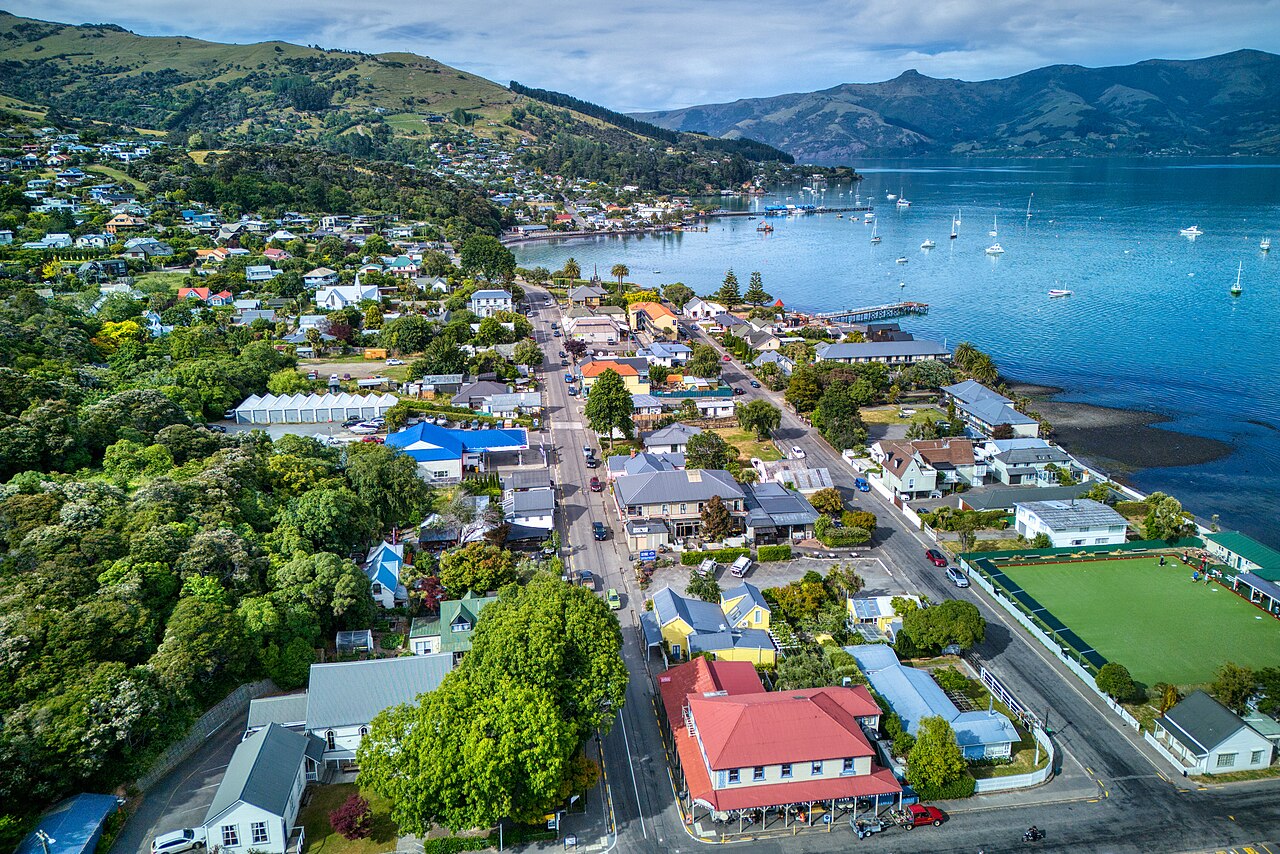
South of Christchurch, the Banks Peninsula — a double volcanic cone jutting out into the Pacific — holds Akaroa, a strikingly pretty little harbour settlement founded by French whalers in 1840 and still trading on its French-New Zealand mix of street names and croissants. Inland, the thermal resort town of Hanmer Springs has outdoor hot pools in an alpine setting. And high in the mountains near Mount Cook, Lake Tekapo with its Church of the Good Shepherd is probably the most photographed spot in the region — it is also part of an International Dark Sky Reserve, one of the largest in the world, and on a clear night the Milky Way is astonishing.