Cherrapunji
©
Cherrapunji

Cherrapunji

Khasi Hills town also known as Sohra, famous for heavy rainfall and living root bridges.

Cherrapunji (also known as Sohra) holds the record for the world's highest annual rainfall — over 11,000 mm in a typical year, with a single-year record of 22,987 mm. Despite being in Meghalaya rather than Assam proper, it is easily visited from Guwahati and frequently included in trips to the northeast.

The town sits on a plateau in the Khasi Hills, with dramatic views south over the plains of Bangladesh. Warm, moisture-laden air off the Bay of Bengal hits the hills and is forced rapidly upward, generating near-constant cloud and rain for much of the year. The best time to visit is October to May, when skies occasionally clear and the waterfalls fed by the monsoon are still flowing strongly.

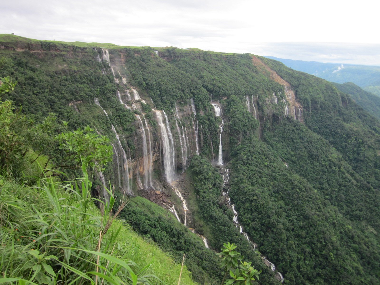
The most unusual attraction is the living root bridges — footbridges made by training the aerial roots of rubber fig trees across rivers and gorges over many decades. The Khasi people have built dozens of these in the valleys below the plateau; the double-decker root bridge near Nongriat village is the most celebrated, reached by a steep descent of around 3,500 steps each way. The waterfalls ringing the plateau are extraordinary: Nohkalikai Falls is the tallest plunge waterfall in India, while the Seven Sisters Falls drops 315 metres in seven parallel streams. Mawsmai Cave offers an accessible glimpse of the limestone cave systems beneath the plateau.

Cherrapunji was founded as a British administrative centre before being overshadowed by Shillong. The strong Welsh missionary presence left a lasting Christian imprint on the local Khasi community.

Guide

Getting There

Cherrapunji is 53 km from Shillong, the capital of Meghalaya, via a winding mountain road that takes around one and a half hours. Shared taxis from Shillong's Bara Bazar taxi stand are the standard way to get there; private taxis are also available. Guwahati, the main regional hub with its airport, is about three hours from Shillong.

There is no train or direct bus from the plains to Cherrapunji. The road from Shillong passes through Mawsynram, another village competing for the title of world's wettest place, which is a detour worth considering on the way back.

Guide

Things to Do

Cherrapunji's main draws are the living root bridges in the valleys below the plateau and the waterfalls fed by the world's heaviest rainfall. Both require physical effort: reaching the double-decker root bridge near Nongriat involves a descent of around 3,500 steps and the same back up; the Seven Sisters waterfall viewpoint is easier but still worth the walk to the cliff edge.

The plateau itself offers views south over the Bangladesh plains on clear days, which tend to come in winter and early spring rather than during the monsoon months. The town is quiet and unhurried — a good base for a few days of walking in one of the most dramatically wet landscapes on earth.

Guide

When to Go

Cherrapunji is one of the wettest places on earth, which affects when to go more dramatically than almost anywhere else. The monsoon runs roughly from May to September, delivering most of the annual 11,000+ mm of rainfall. During this period the waterfalls are at their most spectacular, the vegetation is impossibly lush, and the root bridges look their most dramatic — but the rain is constant and heavy, and the steep paths become very slippery.

October to March is the recommended window for most visitors. The skies clear, the views south over Bangladesh become possible, and the waterfalls are still flowing from stored water. The root bridge trek to Nongriat is far easier on dry paths. December and January are cool — warm layers are useful at the plateau elevation of around 1,300 metres.