Gjogv
©
Gjogv

Gjogv

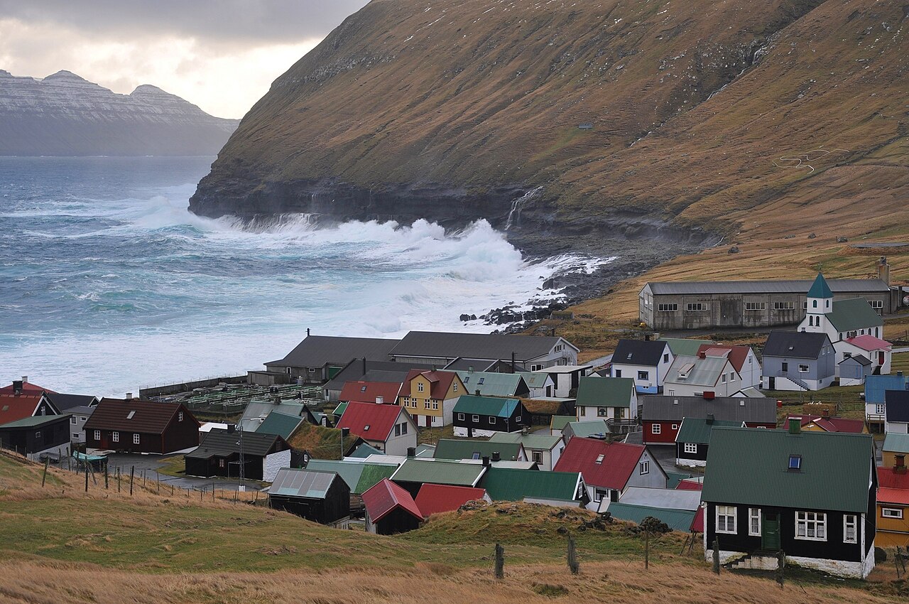
Faroese village named for its basalt cleft, below Slaettaratindur on Eysturoy.

In Faroese, gjogv means cleft, and it could not be more obvious how this village got its name. The gorge cuts deep into the basalt, and it is from stone steps at the bottom that boats set out for fishing and trips around the headland.

From the far side of the cleft you can look across to puffins and other seabirds at close range. Gjogv is well equipped for a village of its size, with a guesthouse and a snack bar — a welcome stop after the mountain road from Eidi. Behind the village rises Slaettaratindur, the highest mountain in the Faroes, and over the pass to the south lies the old wooden Funningur Church.

Guide

Bars and Cafes

There are no bars in Gjógv. The Faroe Islands are broadly dry outside Tórshavn and a handful of larger towns, and Gjógv is a village of fewer than fifty residents with no licensed premises beyond the guesthouse. The Gjáargarður serves coffee and can usually provide a beer or glass of wine to guests; day visitors should not expect a full bar menu.

If you need a drink at the end of the day, the drive back toward Eidi or onward to Tórshavn will take you to better-stocked options.

Guide

Day Trips

Gjógv is a good base for exploring northern Eysturoy and the neighbouring islands. The drive south to Tórshavn takes about an hour, passing through the Eystur sub-sea tunnel under the sound.

Kalsoy — the "flute island" — is reached by ferry from Syðradalur on Kalsoy's western coast, about 35 km south. The hike to the Kallur lighthouse at the northern tip is one of the most photographed walks in the Faroes, with near-vertical cliffs on three sides and views across to Kunoy. The ferry is small and runs infrequently; check the timetable before you go.

Vidoy and Bordoy — the linked northern islands — are a 45-minute drive south and then across to Klaksvík, the second-largest town in the Faroes and a reasonable place to stop for provisions and fuel. From Klaksvík the road continues north through Norðoyatunnilin to Vidoy and Bordoy, with dramatic sea views and the Múlafossur-style cliffs at Enniberg on Vidoy rising 754 metres from the sea.

The coastal hiking trail west from Gjógv toward Tjørnuvík — a walk of four to five hours — leads to another photogenic village at the foot of the sea stacks Risin and Kellingin (the Giant and the Witch), two of the most recognisable formations in the Faroes.

Guide

Eating Out

Gjógv is a village of fewer than fifty people, so dining options are limited to one. The Gjáargarður guesthouse runs the only restaurant in the village, serving simple Faroese food — fish soup, lamb, and occasionally puffin — to guests and day visitors. It is worth stopping here regardless of whether you are staying the night.

Book ahead if you are coming for dinner; the kitchen keeps short hours and visitor numbers are unpredictable. Lunch is more informal. There is also a small snack kiosk near the car park, open in summer, selling coffee and basic provisions to hikers arriving off the trail.

Guide

Getting Around

The village is small enough to walk end to end in five minutes. Everything — the gorge, the guesthouse, the turf-roofed houses, the trailhead for the coastal path — is within easy walking distance of wherever you park.

For the surrounding area you need a car. The coastal path north from Gjógv toward Ambadalur and beyond is walkable, but the mountain trails to Slaettaratindur and the road south to Funningur both require returning to the car park. Keep a detailed map or offline GPS: the trails are not always signed and the fog can descend quickly.

Guide

Getting There

Gjogv sits at the end of road 632, about 63 km north of Torshavn. The drive from the capital takes a little over an hour by way of the Eystur tunnel and the mountain road through Funningur — one of the most scenic stretches in the country, with the road climbing high above the fjord before dropping into the village.

There is no bus to Gjogv. Visitors without a car can take the regional bus to Eidi and either walk the final 11 km along the mountain road or arrange a taxi from there. A rental car is by far the easiest option.

Guide

When to Go

June and July are the best months. The days are nearly endless — the sun barely clears the horizon at midsummer before climbing again — the puffins are nesting on the grassy clifftops south of the village, and the mountain road over the pass is at its greenest. The gorge is dramatic in any weather, but a calm morning is the only time you can safely descend the stone steps to the boat landing at the bottom.

August is still good, with slightly shorter days and the start of autumn colour on the hillsides. Spring — April and May — is cold and very windy but often clear, with the mountains in sharp relief and very few other visitors.

Avoid November through February unless you are after Atlantic storms and solitude. The road over the pass can close in winter, and the village shuts down almost entirely. The Gjáargarður guesthouse typically closes between October and March.