Fort Thompson
©
Fort Thompson

Fort Thompson

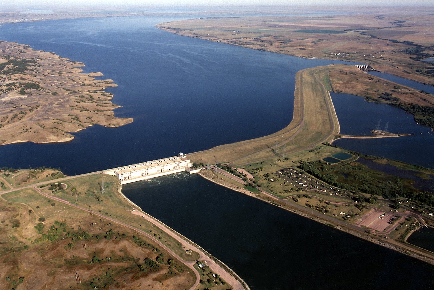
Missouri River reservation town beside Big Bend Dam, Lake Sharpe, and ancient Fort Thompson Mounds.

Fort Thompson sits along the banks of the Missouri River near Big Bend Dam, in the middle of the Crow Creek Sioux Reservation in central South Dakota. It is one of the poorest counties in the nation, but what the area lacks in wealth it makes up for in stark beauty: wide sky, open hills, and the blue expanse of Lake Sharpe — the reservoir the dam created — stretching north toward Pierre.

The landscape carries a complicated history. The dam, completed in 1963, flooded much of the original townsite and reservation bottomland, displacing Crow Creek Sioux families who were never adequately compensated. The Fort Thompson Mounds — ancient burial and ceremonial mounds that survived on higher ground — are the most historically significant site, a reminder of a much deeper continuum of habitation here. There is not much to do in the conventional tourist sense, but the back roads, the reservoir, and the chance to understand this stretch of the Missouri on its own terms make it worth a stop for travelers crossing South Dakota who want more than Mount Rushmore.

Guide

Getting There

Fort Thompson is in central South Dakota, on the Crow Creek Reservation in Buffalo County. It is not served by public transport of any kind — a car is essential. The nearest town of any size is Chamberlain, about 30 miles to the south via US-16 and SD-47, which has a gas station, a few restaurants, and motel accommodation. Pierre, the state capital, is roughly 50 miles to the northwest.

From I-90 (the main east-west freeway across South Dakota), take Exit 265 at Kimball and drive north on SD-45, or Exit 248 at Chamberlain and drive north on SD-47 along the Missouri River. The SD-47 route along the river is more scenic. Flying in is not realistic — the nearest airports with regular commercial service are Pierre Regional Airport and Sioux Falls Regional Airport, both over two hours away by car.

Guide

Things to Do

Fort Thompson's principal draw is its landscape: the Missouri River backed up behind Big Bend Dam to form Lake Sharpe, the hills above the water, and the flat reservation land stretching out in every direction. The Fort Thompson Mounds are the most historically significant site — a complex of ancient burial mounds that survived the flooding of the original Fort Thompson townsite. Big Bend Dam itself is worth a stop to understand what was lost when the Missouri was tamed, and Lake Sharpe draws anglers and boaters from across the region.

Guide

When to Go

The best time to visit Fort Thompson is late spring through early fall (May to September). The Missouri River country is dramatic in any season, but summer gives you access to Lake Sharpe for fishing and boating, and the days are long enough to explore the surrounding reservation back roads properly.

Spring (April–May) is particularly good for birdwatching — waterfowl migration peaks then, with snow geese moving through in huge flocks. Fishing is excellent spring and fall, when walleye are more active in cooler water. Summer temperatures regularly exceed 90°F (32°C), and the plains can be exposed and harsh in high summer heat. Winters are severe: temperatures well below freezing, wind, and occasional heavy snow make travel difficult and most outdoor appeal disappears. If you are visiting primarily for the landscape and archaeological sites rather than fishing, late May or early September gives the best combination of mild weather and open access.