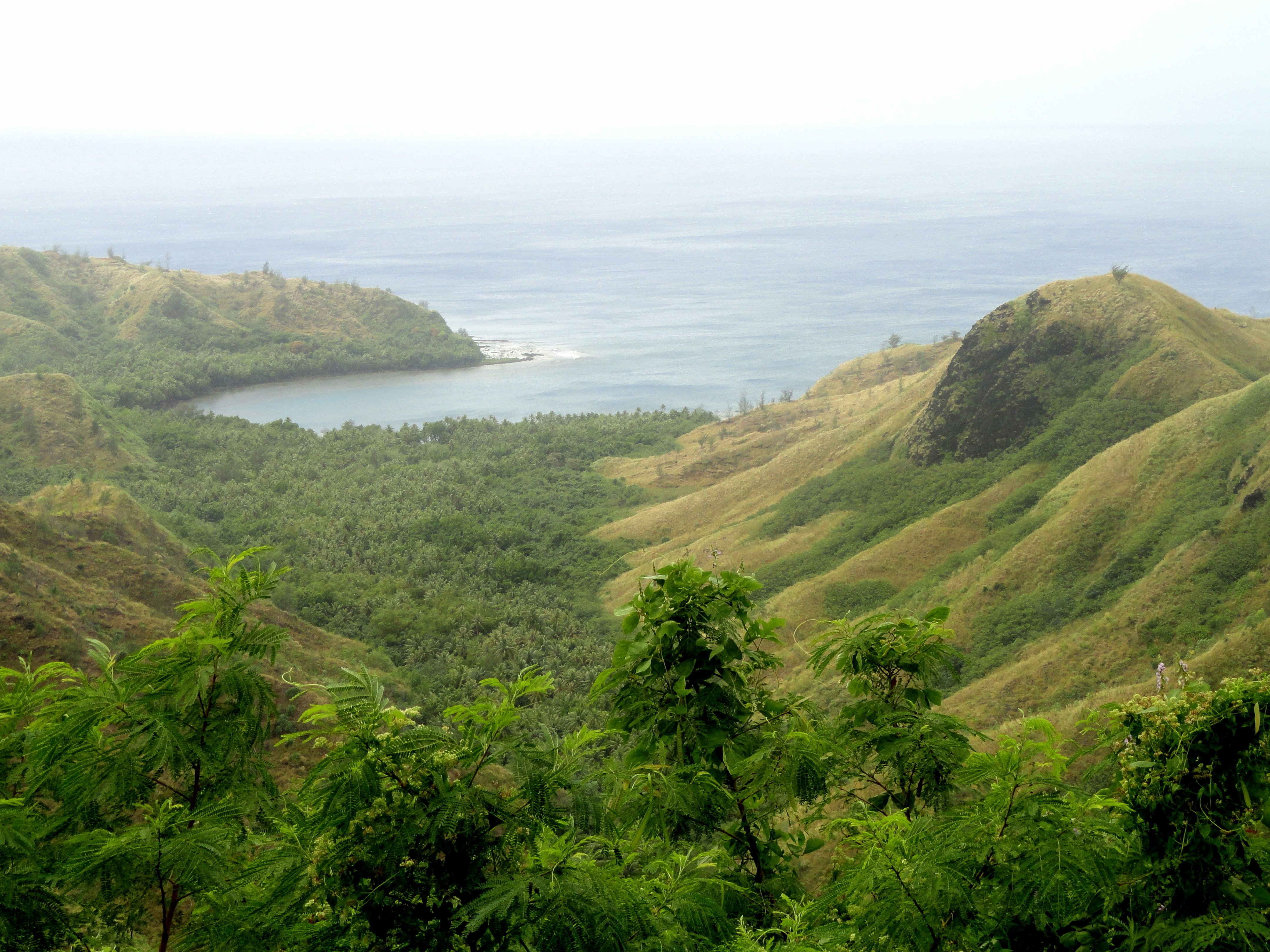
Cetti Bay
©
Cetti Bay

Cetti Bay

Rugged Guam bay on the southwest coast, framed by forested hills, reef, and Chamorro sacred sites.

Cetti Bay is a rugged stretch of the southwestern coast of Guam, reached by Route 4 — the scenic coastal road that loops around the southern half of the island. The bay itself is a broad, undeveloped crescent of water ringed by steep forested hills and exposed reef — not a swimming beach (strong currents, exposed reef) but a classic Pacific viewpoint, usually photographed from the Cetti Bay Overlook, where a short walk from the car park gives you a sweeping view down over the bay and the Philippine Sea beyond.

This corner of Guam is also home to two remarkable natural landmarks. Fouha Point — also known as Creation Point — is the most sacred site in Chamorro culture, the place where the first humans are said to have emerged from the rock. It is a National Natural Landmark but sees very few visitors. Nearby, Mount Lamlam is Guam's highest peak at 406 metres and offers a straightforward hike with panoramic views over both coasts of the island. This stretch of southern Guam feels entirely different from the resort-dense northern coast.

Guide

Bars and Cafes

There are no bars or cafes in the Cetti Bay area. The southern coastal road is essentially undeveloped for long stretches, and this part of Guam sees little tourist infrastructure. Bring water — the sun on the exposed hillsides and overlook platforms is intense at any time of year. If you need supplies or a cold drink, Agat (about 10 km north on Route 4) has convenience stores and a petrol station.

Guide

Day Trips

The southern coastal road (Route 4) strings together several of Guam's most historically and scenically interesting spots, all within easy driving distance of Cetti Bay.

Umatac is the closest village to the south, about 5 km along the coast. It is where Ferdinand Magellan is said to have made his first landfall in the Marianas in 1521, and the village commemorates this with a fort and an annual festival. The bay at Umatac is calm and picturesque, and there are remnants of Spanish-era defences on the hillside above. It takes about 20 minutes to poke around.

Merizo lies a few kilometres beyond Umatac and is one of the best-preserved Chamorro villages on Guam. From Merizo, short boat trips run out to Cocos Island — a small reef-ringed island with good snorkelling and a calm, shallow lagoon. Cocos Island is one of the few places in the Guam area where you can actually swim in clear water without strong currents.

Inarajan on the southeastern coast, reached by continuing on Route 4 or cutting across the island, has a natural swimming pool formed by a reef — popular with families and one of the better swimming spots on the southern coast.

The full loop around southern Guam on Route 4 takes about three hours without stopping; allow a full day if you want to stop at Umatac, Merizo, and Inarajan.

Guide

Eating Out

There are no restaurants in Cetti Bay itself — this is one of the most remote and undeveloped corners of Guam. The nearest reliable options are in the village of Umatac to the south, which has a small store and occasional food stalls, or in Agat to the north. If you are spending the day hiking or at the overlook, bring your own food and water. The southern coastal road has very limited services along its entire length.

Guide

Getting Around

Once at Cetti Bay, the area is navigated on foot. The Cetti Bay Overlook itself is a short walk from the roadside car park — a few minutes along a concrete path. The Mount Lamlam trail begins near the overlook and takes about 45 minutes to reach the summit; the path is clear but steep in places. Fouha Point requires a longer walk through secondary jungle and is less straightforward — the trail is not always well-marked, and it is worth asking locally before attempting it.

There is no shuttle or organised transport within the area. Distances between the overlook, the Mount Lamlam trailhead, and the Fouha Point access track are small enough that you can drive between them in a few minutes. Wear sturdy shoes, bring more water than you think you need, and start hikes in the morning before the heat builds.

Guide

Getting There

Cetti Bay is on Route 4 (Marine Corps Drive / Marine Drive), which follows the southwestern coastline of Guam. From Tumon Bay (the main resort area in the north), take Route 1 south through Hagatña and Agat — total driving time is around 45 minutes to an hour depending on traffic and stops. The Cetti Bay Overlook has a small car park on the roadside; it is hard to miss.

There is no public transport to Cetti Bay. A rental car is the practical option for the day. Car hire is widely available in the Tumon and Hagatña areas. The road is sealed all the way and accessible in a standard car, though some of the side tracks and trailheads are better suited to a 4WD.

Ride-sharing apps and taxis exist on Guam but are not well suited to a full day on the southern coast. If you plan to hike Mount Lamlam and visit Fouha Point in the same day, a rental car gives you the flexibility to move between trailheads without back-tracking.

Guide

Things to Do

Cetti Bay's attractions are almost entirely natural — the overlook, the coastal scenery, and the hiking trails into the surrounding jungle. This is the southwestern tip of Guam, where Spanish-era fortifications, Chamorro sacred sites, and untouched reef wait for those willing to leave the northern resort strip behind.

Guide

When to Go

Guam has a tropical climate with two seasons: a dry season from January to June, and a wet season from July to December. For hiking around Cetti Bay — the overlook, Mount Lamlam, and the trails down to Fouha Point — the dry season is considerably more pleasant. Trails become slippery and overgrown during the wet season, and the views from the overlook are often obscured by cloud and haze after heavy rain.

The best time to visit is early morning in the dry season (February to May). The light is better for photography, the heat is manageable before midday, and there is less chance of afternoon cloud rolling in from the hills. Avoid midday in any season — the exposed ridgeline on the Mount Lamlam trail and the open platforms at the overlook offer no shade, and temperatures regularly exceed 30°C.

Typhoon season overlaps with the wet season and peaks between August and November. Typhoons are infrequent but can be severe; check forecasts if travelling in this period.