Steep Dutch Caribbean island of volcanic slopes, cloud-forest hikes, and reef diving without resort beaches.
Saba is the Caribbean at its most improbable — a single volcanic peak rising straight out of the sea, five square miles of near-vertical terrain, no beaches to speak of, and a permanent population of about 2,000. If you came looking for a resort island, you have landed on the wrong rock. If you came to hike through cloud forest, dive pristine reefs, and stay in a place where everybody knows your name by the second day, Saba is perfect.
The island is a special municipality of the Netherlands, lying 28 miles south of Sint Maarten. Four tiny villages cling to the slopes: The Bottom (the capital, despite being in a crater), Windwardside (the main tourist settlement), St. John's, and Hell's Gate. A single road — called, without exaggeration, "The Road" — connects them all, threading through hairpin turns cut into the mountainside.
The big draw on land is Mount Scenery, at 877 metres the highest point in the entire Kingdom of the Netherlands. A well-maintained trail climbs from Windwardside through elfin forest draped in moss and bromeliads to the summit — allow two hours up and plan to arrive before clouds close in around midday. Underwater, the Saba National Marine Park protects some of the best diving in the Caribbean: pinnacles, walls, and lava formations teeming with sharks, turtles, and huge barrel sponges.
Guide
Getting There
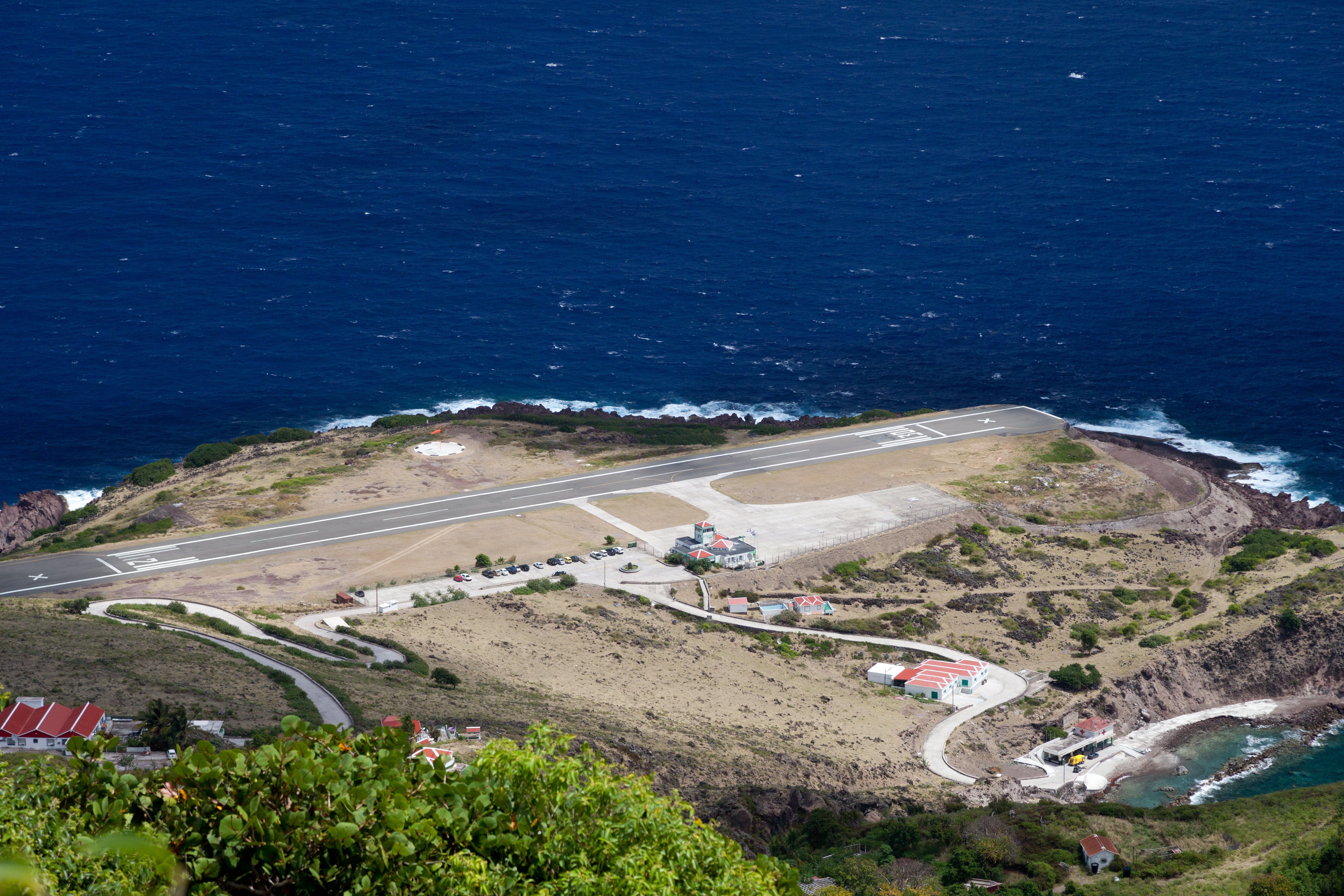
Almost all visitors arrive via Sint Maarten. Winair operates several daily flights from Princess Juliana Airport (SXM) to Saba's Juancho E. Yrausquin Airport (SAB) — a twelve-minute hop in a small turboprop. The runway at SAB is just 400 metres long, one of the shortest commercial strips in the world, and the approach between the cliffs is genuinely thrilling.
By sea, The Edge ferry runs from Simpson Bay in Sint Maarten to Fort Bay on Saba. The crossing takes about 90 minutes and can be rough — the channel between the islands is open Atlantic. Check schedules in advance, as sailings depend on weather and demand.
There is no direct international service to Saba. Fly to Sint Maarten first and connect from there.
Guide
When to Go
Saba's climate is relatively consistent year-round — the trade winds keep temperatures comfortable at altitude and humidity is lower than on flatter Caribbean islands. The main tourist season runs December through April, when the weather is drier and seas calmer. This is the best time for diving, as visibility is at its highest and the Saba National Marine Park's rougher northern sites are most accessible.
May through November is the Atlantic hurricane season. Saba is not perfectly sheltered — the island has taken direct hits and its compact size makes evacuation difficult — but it sits slightly outside the main hurricane track and tends to see more tropical waves and heavy rain than direct storms. Diving remains good outside the peak of the season (August to October). The upside of the shoulder season is that the island is even quieter than usual and accommodation prices drop.
The best hiking conditions are December through March, when morning cloud cover is least likely to obscure the Mount Scenery summit. Whatever time of year you visit, mornings are always clearer than afternoons.