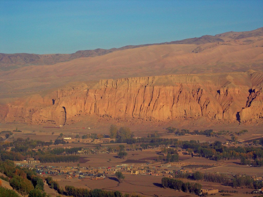
High Hindu Kush valley where cliff niches and Band-e Amir lakes frame Bamiyan's history
The Bamiyan valley sits at 2,590 metres in the Hindu Kush, roughly 230 km northwest of Kabul. It is a place of stunning natural beauty — surrounded by dramatic cliffs and the turquoise Band-e Amir lakes — and carries one of the most poignant stories in world archaeology: the two giant Buddha statues that once dominated the valley cliffs, carved in the 6th and 7th centuries AD, were dynamited by the Taliban in March 2001 in an act of deliberate cultural destruction that shocked the world.
The Buddhas are gone, but the niches remain — vast empty alcoves cut into the sandstone cliffs, which still draw visitors trying to understand the scale of what was lost. Chinese pilgrims Fa-hsien (around 400 AD) and Xuanzang (630 AD) both described the statues in their travel diaries: the larger stood 55 metres high, the smaller 38 metres, both finished with plaster and painted, gleaming with gold leaf and jewels when Xuanzang saw them. The surrounding cliffs contain hundreds of ancient cave dwellings and meditation cells used by Buddhist monks — many are still accessible.
Beyond the archaeological sites, the valley is remarkable for its landscape. The Band-e Amir national park, about 75 km to the west, holds a series of six deep-blue crater lakes separated by natural travertine dams — one of Afghanistan's most extraordinary natural sights. Closer in, the ruined Ghorid citadels of Shahr-e-Gholghola above the town and Shahr-e-Zohak at the eastern gate of the valley are reminders of Genghis Khan's 1221 sack of the region. In summer, the valley itself is green and cool, a welcome contrast to the heat of Kabul.
Travel to Bamiyan requires careful planning given security conditions. The Hazara population of the valley has historically been more welcoming to visitors than other parts of Afghanistan, and the road from Kabul — though long and rough — passes through dramatic mountain scenery.
Guide
Getting There
The road from Kabul to Bamiyan is about 230 km but takes between 6 and 10 hours depending on the route and the security situation. There are two roads:
The southern route via Wardak and Maidan Shahr is shorter, paved for most of the way, but historically more dangerous because of Taliban presence south of Kabul.
The northern route via Parwan, the Salang/Shibar Pass, and Doshi is longer (about 8–10 hours), unpaved in places, but historically safer and considered more scenic — through dramatic Hindu Kush passes.
A small Bamyan Airport (BIN) operates flights to and from Kabul — when conditions permit, this is the easier option. Operated under various names over the years; check schedules close to your travel date.
Drive yourself only with local knowledge. A driver-and-vehicle hire through a reputable Kabul agency is the standard arrangement for foreign visitors; it includes security risk assessment and route planning. Conditions and routes change quickly; check the situation in the days before you travel.
Guide
When to Go
Bamiyan sits at about 2,500 metres in the central Hindu Kush, and the climate is determined by altitude.
Summer (May to September) is the only practical season for most visitors. Days are warm and clear, the valley is green and the apricot trees are in fruit, the road to Band-e Amir is open, and the air is dry. June through August is the peak.
Winter (November to March) is severe — heavy snow closes the high passes between Bamiyan and Kabul, often for weeks at a time, and the cold drops well below -20°C. Don't try to drive in.
Shoulder months (April, October) are unpredictable — sometimes warm and clear, sometimes snowy.
The annual Buddha Day events around 22 March (Nowruz, the Afghan New Year) draw local crowds to the cliff. Security conditions across Afghanistan can change rapidly; check the situation close to your travel date.