Datil
©
Datil

Datil

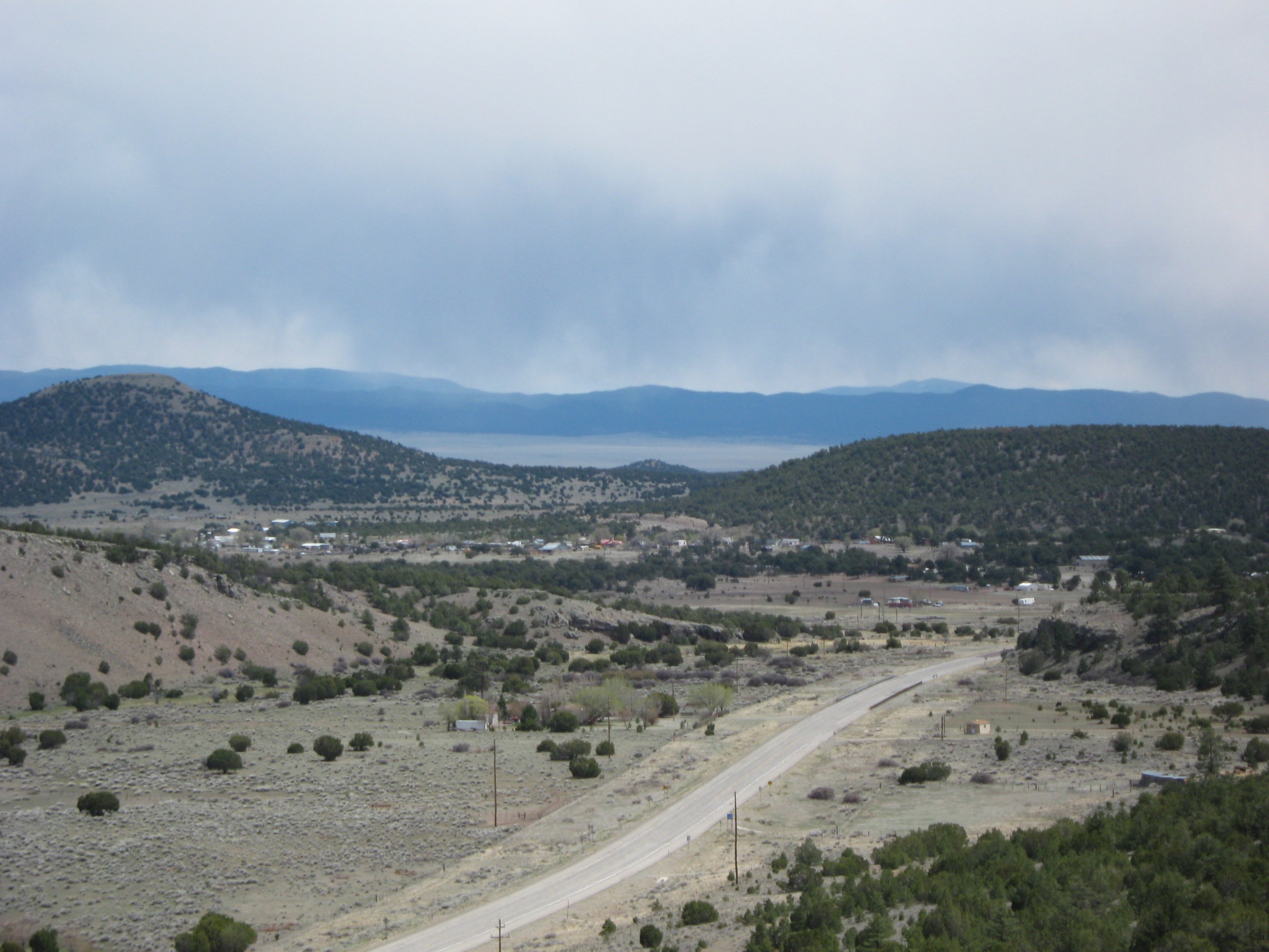
Tiny New Mexico ranching village near Datil Well and the Very Large Array basin.

A tiny ranching village on US-60 in west central New Mexico. The BLM campground at Datil Well is a pleasant overnight stop -- it marks the spot where cattle were watered on their way to Magdalena and the railroad. If you are driving the lonely stretch between Socorro and Pie Town, this is your midpoint.

Datil's main draw, though, is what stretches out to the south: the Plains of San Agustin, an enormous high-desert basin that hosts the Very Large Array — twenty-seven radio telescope dishes arranged across miles of dry lake bed, one of the most striking man-made sights in the American Southwest. Allow half a day for the side trip; the visitor centre is open every day until sunset.

Guide

Day Trips

Pie Town (22 miles west on US-60) is a hamlet almost as small as Datil but with an outsized reputation, mostly built on the Pie-O-Neer café and its rotating selection of New Mexico–style pies. The drive west from Datil climbs through the Datil Mountains on a beautiful stretch of highway. Pie Town was famously documented by photographer Russell Lee for the Farm Security Administration in 1940, and the images of Depression-era homesteaders are displayed in the café.

Gila Wilderness — the first designated wilderness area in the United States, designated in 1924 at the instigation of Aldo Leopold — begins about 50 miles south of Datil and covers more than 500,000 acres of the Mogollon Mountains. The Gila Cliff Dwellings National Monument (around 90 miles by road from Datil via NM-12 and NM-35) protects cliff dwellings built by the Mogollon people around 1280 CE, reached by a short trail through a canyon. Allow a full day; the roads are good but slow.

Magdalena (40 miles east on US-60) is the nearest proper town, with a gas station, grocery, and the quiet charm of a 19th-century cattle-shipping hub that hasn't been over-restored. The Magdalena Mountains rise immediately above town, and the Langmuir Research Site atop South Baldy Peak (operated by New Mexico Tech) is visible from town. Socorro, another 25 miles east, is the regional hub with full services, restaurants, a university campus, and the Bosque del Apache National Wildlife Refuge a short drive south — one of the best places in the USA to see sandhill crane and snow goose migrations in autumn and winter.
Guide

Eating Out

Eating options in Datil amount to the Eagle Guest Ranch and not much else. The Eagle, at the US-60/NM-12 junction in the centre of the village, has a small diner-style restaurant serving green-chile burgers, breakfast plates and pies — it doubles as the gas station, motel and general store. If it is closed (and it sometimes is), the next options either direction along US-60 are Pie Town to the west (about 22 miles) for a slice of pie at the Pie-O-Neer and Magdalena to the east (about 40 miles) for the Bear Mountain Cafe.

Guide

Getting Around

You need your own vehicle for everything here. Datil itself is a few hundred yards along US-60, but the attractions that make a stop worthwhile — the Very Large Array, the Plains of San Agustin, the trailheads into the Gila National Forest — are spread across a large area of back-country roads and require a car. A standard two-wheel-drive vehicle is sufficient for all the main destinations in good weather; the road to the VLA visitor centre is paved the whole way.

Cell service is intermittent to non-existent across the Plains of San Agustin, so download any maps or directions before you leave town. The BLM campground at Datil Well is a mile north of the highway on a good gravel road. The side road south to the VLA branches off NM-52 from Datil and is straightforward in dry conditions.

Guide

Getting There

Datil is on US Route 60, one of the great east-west highways across the American Southwest. From the east, Socorro is 60 miles away — take I-25 to Socorro then head west on US-60 through Magdalena and across the plains. From the west, Springerville in Arizona is about 110 miles, passing through the Glenwood area and climbing up through the Datil Mountains. There is no public transport of any kind on this stretch; a car is essential.

The nearest airport with regular service is Albuquerque International (ABQ), 115 miles northeast. From Albuquerque, take I-25 south to Socorro and then US-60 west — allow around two hours depending on stops. Rental cars are readily available at the airport.

Fuel is available at the Eagle Guest Ranch at the centre of the village, but hours are irregular and the range of fuels limited. Fill up in Socorro or Magdalena coming from the east, or in Springerville or Reserve coming from the west, rather than relying on Datil.

Guide

Things to Do

Datil is a one-blink village, and the things worth seeing here are spread out across the high plains in every direction. The Very Large Array radio telescope on the Plains of San Agustin is the headline attraction and one of the most photographed scientific installations in the country. Closer to town, the Datil Well Campground sits on an old cattle-drive watering hole with a short interpretive trail and big sky views, and the broader Cibola National Forest spreads north and south of US-60 for hiking and birdwatching.

Guide

When to Go

Datil sits at 7,400 feet and the high elevation means the climate is milder than most of New Mexico in summer — July and August highs are typically in the low eighties Fahrenheit, with afternoon thunderstorms that roll in reliably from mid-afternoon and are gone by evening. The Plains of San Agustin catch spectacular lightning storms during monsoon season (July through September), and the night skies at Datil Well Campground are among the darkest in the state on clear nights between storms.

Spring and autumn are the best times to visit. April and May bring wildflowers across the grasslands and good birdwatching; September and October offer clear skies, cool temperatures, and the pronghorn that range across the plains in numbers. Winters are cold, occasionally snowy, and very quiet — US-60 stays open, but the Eagle Guest Ranch may have reduced hours, and it is worth fuelling up and carrying water before heading out onto the plains.

The VLA is open every day of the year, and the walk among the dishes is pleasant at any season. If you want to join a free guided tour, those run on the first Saturday of each month.