Dalvíkurbyggð
©
Dalvíkurbyggð

Dalvíkurbyggð

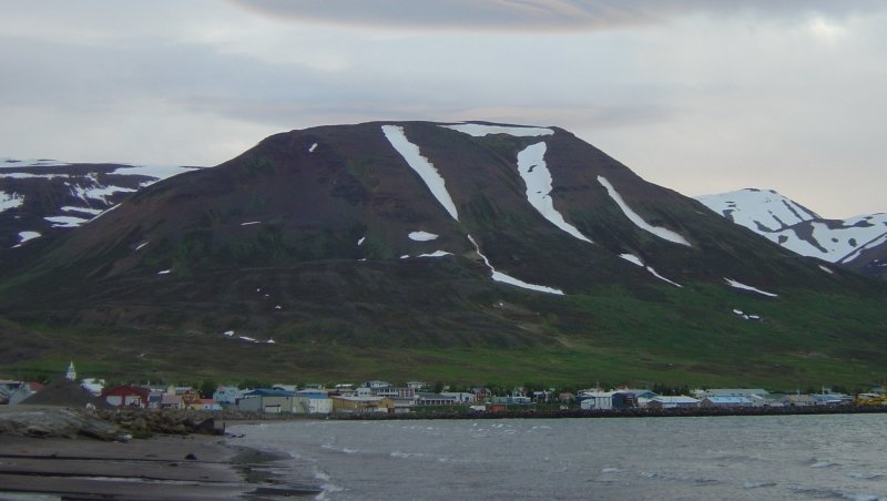
Northern Iceland fishing municipality on Eyjafjörður, with ferries to Grímsey and Tröllaskagi mountain scenery.

Dalvíkurbyggð is a small municipality on the western shore of Eyjafjörður, northern Iceland's largest fjord. The main town of Dalvík (population around 2,000) is a working fishing port that serves as the departure point for the ferry to Grímsey — Iceland's northernmost inhabited island, sitting right on the Arctic Circle.

The area is a good base for exploring the Tröllaskagi peninsula, one of Iceland's most scenic coastal stretches with dramatic mountain passes and remote fjords. Dalvík itself hosts the annual Fiskidagurinn mikli (Great Fish Day) festival in August, where the town's entire catch is grilled and served free. Whale watching tours operate from nearby Hauganes.

From Árskógssandur, a short drive south, a ferry crosses to Hrísey, a small island in the middle of the fjord known for its birdlife and tranquility. The Svarfaðardalur valley inland offers horseback riding and farmhouse accommodation.

Guide

Day Trips

The headline day trip from Dalvík is Grímsey, Iceland's northernmost inhabited island and the only part of the country to sit on the Arctic Circle. The Sæfari ferry sails from Dalvík harbour three times a week, taking about three hours each way; some sailings allow a day return, while others mean an overnight in the island's guesthouse. The Arctic Circle monument is the obvious draw, but the seabird cliffs — packed with puffins, razorbills, and guillemots in summer — are the better reason to go.

Closer to hand, Hrísey lies in the middle of Eyjafjörður, reached by a 15-minute ferry from Árskógssandur about 20 km south of Dalvík. It is a quiet, low island of heathland trails and tame ptarmigan, with a mild microclimate and fjord views toward the mountains. A few hours covers the marked walks.

Inland and to the northwest rises Tröllaskagi, the rugged peninsula whose mountain passes and coastal roads connect Dalvík to the fishing towns of Ólafsfjörður and Siglufjörður. Allow a full day to drive it, stopping for the old mountain viewpoints above the tunnels and, in Siglufjörður, the excellent Herring Era Museum.

Guide

Getting Around

Dalvík itself is a small town where most things are walkable. The Grímsey ferry departs from Dalvík harbour; check the Samskip ferry schedule for current days and times (typically three times a week). The Hrísey ferry departs from Árskógssandur, about 20 km south, and runs frequently in summer.

A car is effectively essential for reaching Svarfaðardalur and the other inland areas. Public transport within the municipality is minimal.

Guide

Getting There

Dalvík is 26 km north of Akureyri on the western shore of Eyjafjörður. By car from Akureyri, follow Route 82 north along the fjord — the drive takes about 25 minutes. Akureyri Airport (AEY) has flights from Reykjavík Domestic Airport operated by Icelandair and Eagle Air; the journey from Reykjavík by air is about 45 minutes.

From Reykjavík by car, the drive along Ring Road 1 takes about 5 hours. Akureyri is the logical base for anyone arriving by the long-distance Strætó bus service from Reykjavík (about 6 hours). Local buses connect Akureyri with Dalvík, though service is infrequent.

Guide

When to Go

Summer (June–August) is the obvious season, when the Grímsey ferry runs most reliably, whale watching is at its peak, and the Great Fish Day festival takes place on the second Saturday of August. The midnight sun in late June and July means that Grímsey, right on the Arctic Circle, gives you the most dramatic experience of the phenomenon in Iceland.

Winter offers the possibility of seeing the Northern Lights over the fjord and mountains, and the area is much less visited — Dalvík in January is a very different place from the summer tourist stop. The Grímsey ferry runs year-round but less frequently. Mountain roads and passes in the Tröllaskagi area may be closed by snow from October through April.