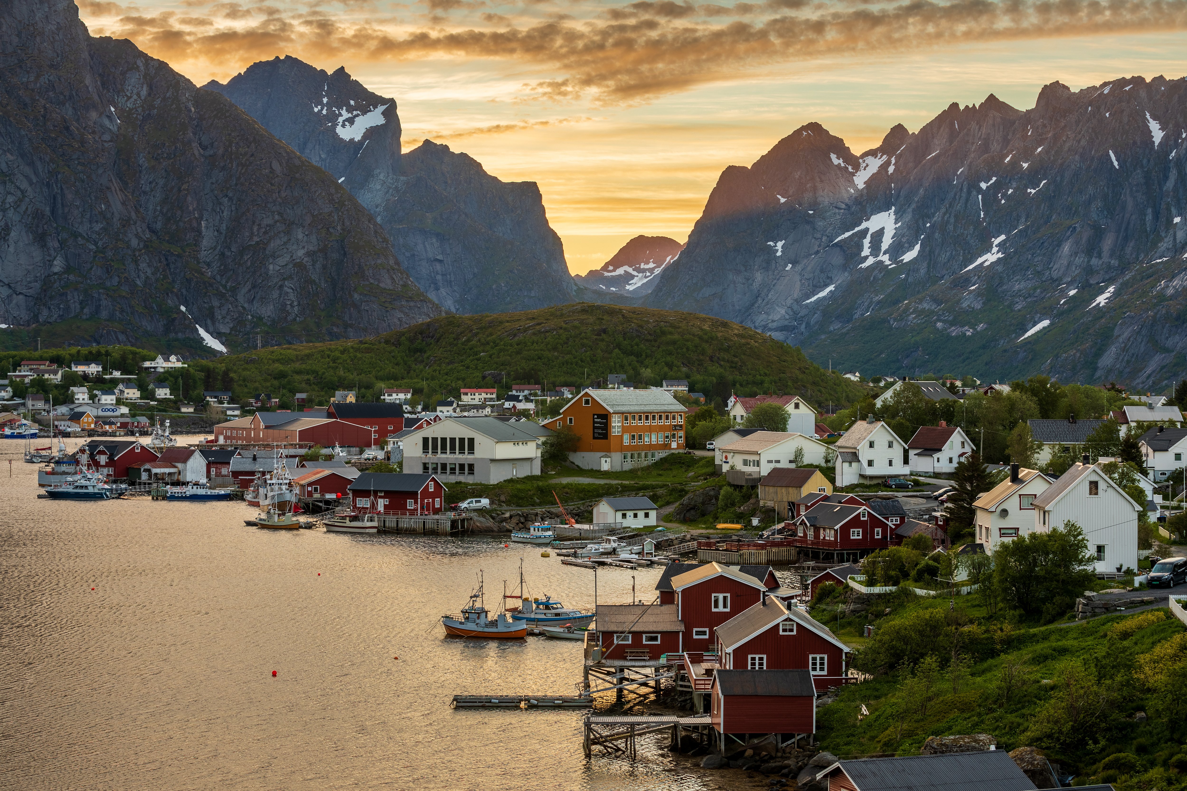
Moskenes municipality covers the southern part of Moskenes Island in the Lofoten archipelago, where glaciers and elemental forces have sculpted the landscape into one of the wildest and most dramatic corners of Norway. Hermannsdalstind at 1,029 metres is the highest peak in western Lofoten, and mountain lakes dot the terrain, offering excellent freshwater fishing.
The landscape is defined by sheer mountains dropping almost directly to a narrow shoreline. Until the 1950s, small communities clung to the exposed western side of the island facing the open ocean; today, settlement concentrates on the sheltered eastern shore, where good harbour conditions serve the fishing fleet, cargo vessels, and increasing numbers of pleasure boats.
The fishing villages string along the eastern coast like beads — Hamnøy, Sakrisøya, Reine, Sørvågen, and Å are among the most beautiful. Many travellers rent a traditional fisherman's cabin (rorbuer) and spend days exploring on foot or by kayak. The famous Moskenesstraumen, the powerful maelstrom off the southern tip of the island, is one of the strongest tidal currents in the world — organized boat trips venture out to experience it, and from the water you can also reach the Kollhellaren cave in Refsvika, which contains cave paintings some 3,000 years old.
At the Norwegian Fishing Village Museum in Å, you can walk through a complete preserved fishing village with 14 buildings still in their original use, including a working bakery and blacksmith's forge. The stockfish museum nearby tells the thousand-year story of dried cod as a trade commodity. On Sakrisøya, Dagmar's Museum of Dolls and Toys makes for an unexpected detour. A marked hiking trail from Sørvågen leads in about two hours to the Munkebu mountain cabin run by the Norwegian Trekking Association — an excellent overnight option in summer.